Site C. 1 Hectare / C, 2.47 Acres, Subject To Planning Or Sold As Is, Wil, Navan, County Meath
Agricultural Land For Sale
Price On Application
Print additional images & map (disable to save ink)
Telephone:
(046) 902 3232View Online:
www.tjgavigan.ie/1071342Key Information
| Address | Site C. 1 Hectare / C, 2.47 Acres, Subject To Planning Or Sold As Is, Wil, Navan, County Meath |
|---|---|
| Price | Last listed at Price On Application |
| Land type | Agricultural Land |
| Size | 2.47 acres |
| Status | Sale Agreed |
| PSRA License No. | 001249 |
Features
- Site C. 1 hectare / 2.47 acres
- Clearly defined boundaries
- Road frontage off two roads main R162 & L74113
- Convenient yet private rural location
- Potential for one-off dwelling (S.T.P.P.)
- Local Needs criteria will apply
- Offered subject to planning or as is
Additional Information
LOCATION
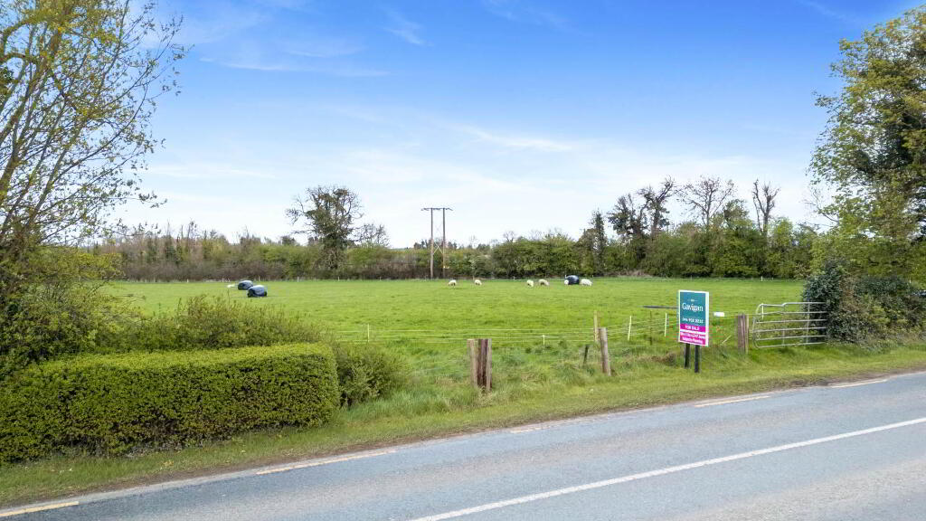
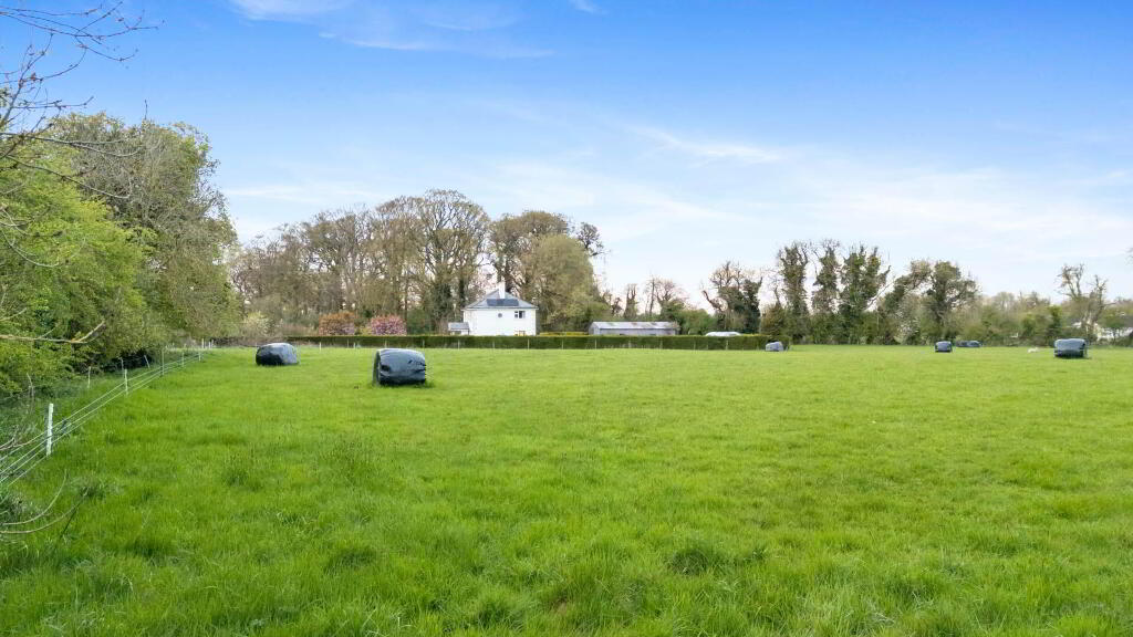
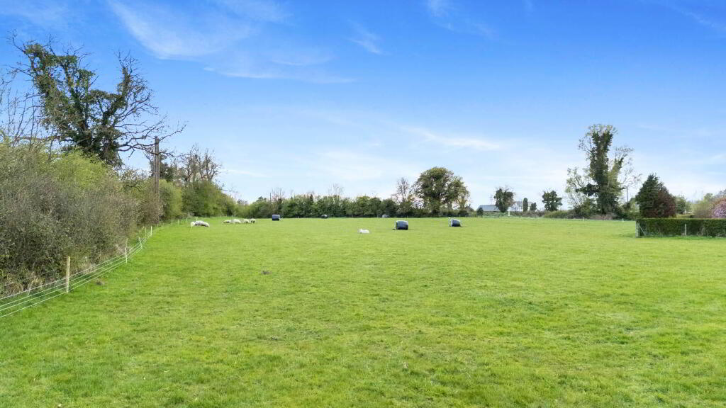
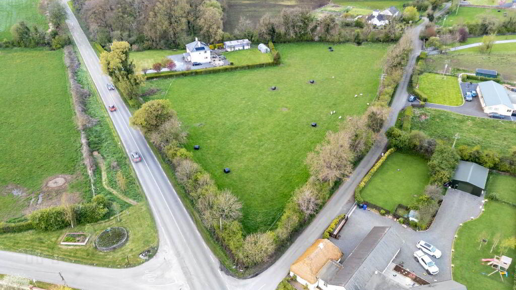
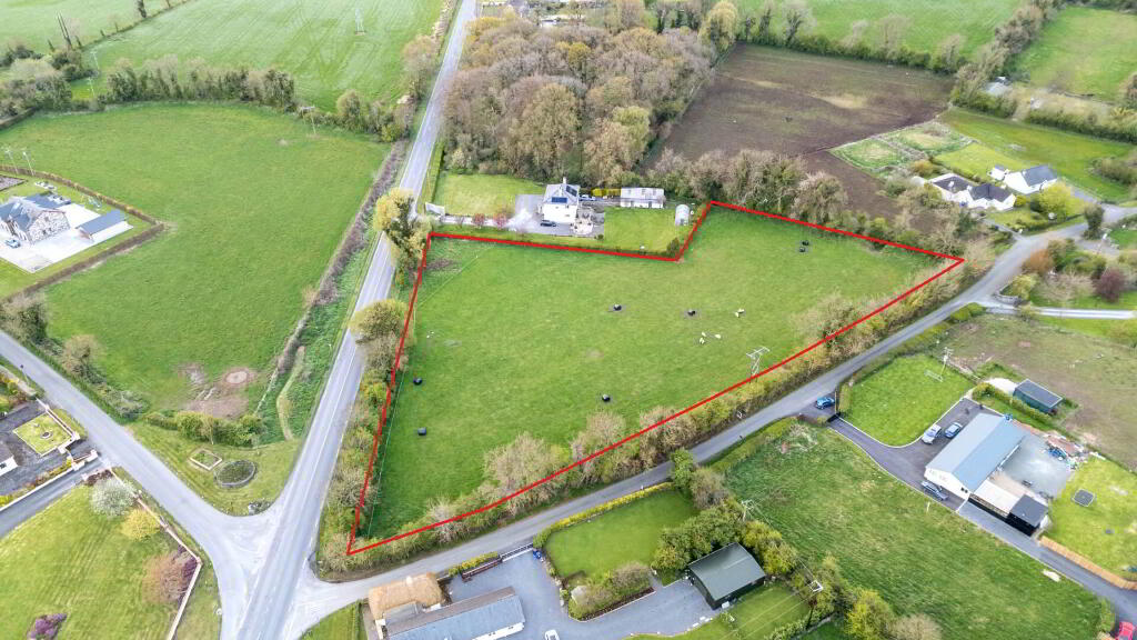
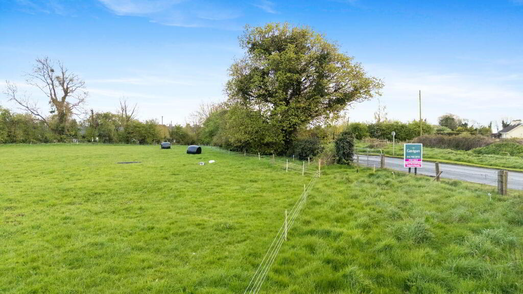
An excellent opportunity to acquire a well-located site in a sought-after rural setting.
The property is situated in a quiet rural setting in Wilkinstown, a well-regarded residential location just a short distance from Navan town.
The site enjoys a convenient position with easy access to the R163 / Navan Slane Road network, while still offering a peaceful countryside environment.
GPS Coordinates:
53.743247, -6.715190
DESCRIPTION
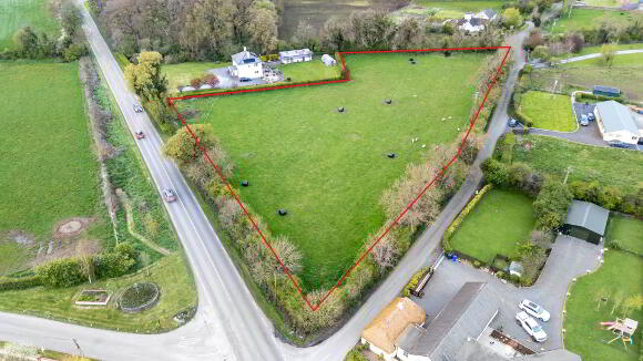
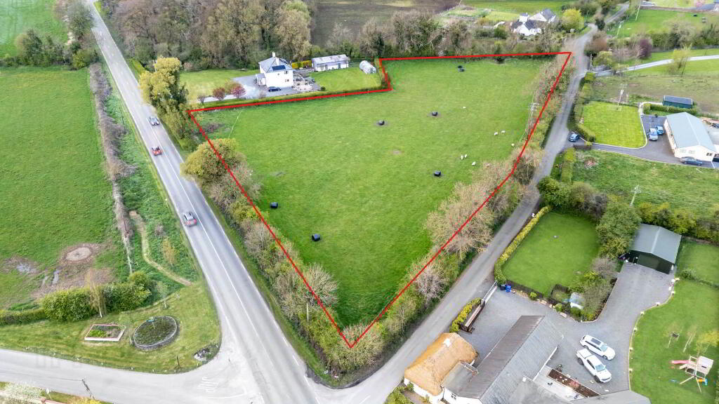
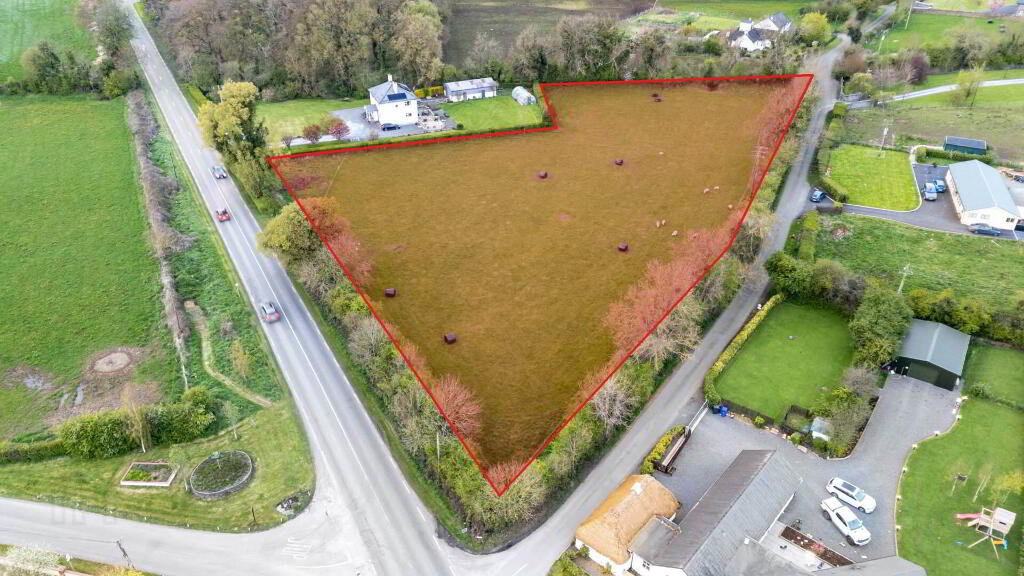
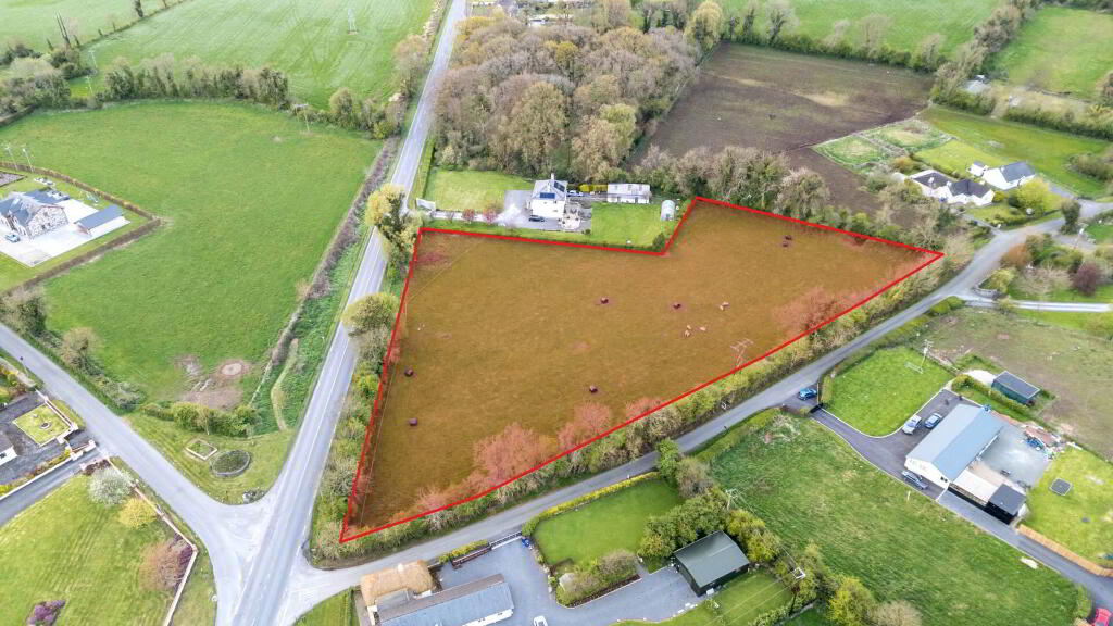
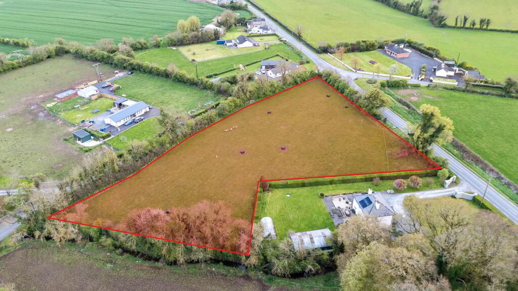
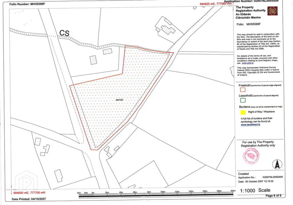
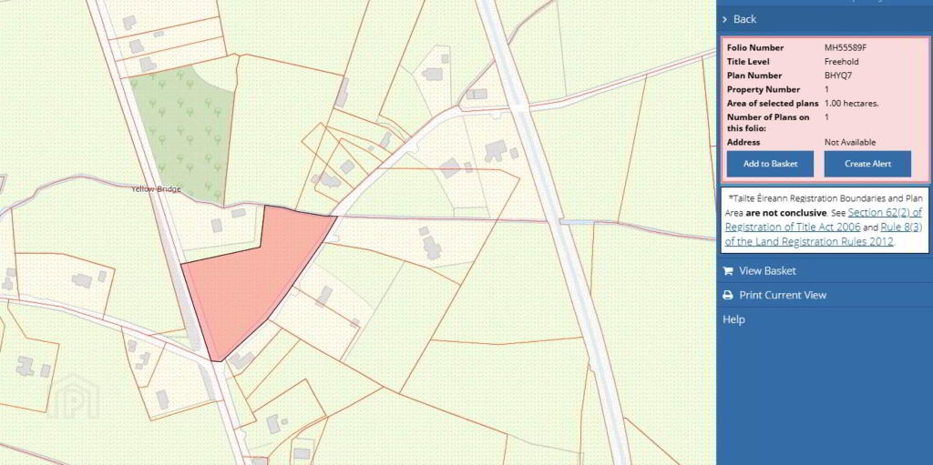
A very attractive parcel of land extending to approximately c. 1.00 hectare (c. 2.47 acres), contained within a clearly defined boundary as outlined on the attached Land Registry map.
The site is generally level in nature and benefits from dual road frontage off main R162 c. 90 meters and L74113 c. 160 meters offering potential for a one-off residential dwelling subject to the necessary planning permission.
The property is being offered for sale either Subject to Planning Permission, or
As is (unconditional sale).
This provides flexibility for a purchaser depending on their requirements.
PLANNING
The property is located in a rural area where Local Needs restrictions will apply.
Any intending purchaser should satisfy themselves that they meet the relevant Meath County Council Local Needs criteria prior to committing to a purchase subject to planning.
No planning permission is currently attached to the lands nor was planning previously applied for.
MAPS & IDENTIFICATION
The lands are comprised within Folio No. MH55589F and are outlined in red for identification purposes only.
Note: Boundaries are for guidance only and are not conclusive.
SERVICES
Interested parties should satisfy themselves as to the availability of services, including:
Water
Drainage (septic tank/percolation area likely required)
Electricity
TITLE
Freehold Title
Directions
GPS COORDINATES
53.743247, -6.715190
what3words /// vine.permitting.stairway
Notice
Please note we have not tested any apparatus, fixtures, fittings, or services. Interested parties must undertake their own investigation into the working order of these items. All measurements are approximate and photographs provided for guidance only.
An excellent opportunity to acquire a well-located site in a sought-after rural setting.
The property is situated in a quiet rural setting in Wilkinstown, a well-regarded residential location just a short distance from Navan town.
The site enjoys a convenient position with easy access to the R163 / Navan Slane Road network, while still offering a peaceful countryside environment.
GPS Coordinates:
53.743247, -6.715190
DESCRIPTION
A very attractive parcel of land extending to approximately c. 1.00 hectare (c. 2.47 acres), contained within a clearly defined boundary as outlined on the attached Land Registry map.
The site is generally level in nature and benefits from dual road frontage off main R162 c. 90 meters and L74113 c. 160 meters offering potential for a one-off residential dwelling subject to the necessary planning permission.
The property is being offered for sale either Subject to Planning Permission, or
As is (unconditional sale).
This provides flexibility for a purchaser depending on their requirements.
PLANNING
The property is located in a rural area where Local Needs restrictions will apply.
Any intending purchaser should satisfy themselves that they meet the relevant Meath County Council Local Needs criteria prior to committing to a purchase subject to planning.
No planning permission is currently attached to the lands nor was planning previously applied for.
MAPS & IDENTIFICATION
The lands are comprised within Folio No. MH55589F and are outlined in red for identification purposes only.
Note: Boundaries are for guidance only and are not conclusive.
SERVICES
Interested parties should satisfy themselves as to the availability of services, including:
Water
Drainage (septic tank/percolation area likely required)
Electricity
TITLE
Freehold Title
Directions
GPS COORDINATES
53.743247, -6.715190
what3words /// vine.permitting.stairway
Notice
Please note we have not tested any apparatus, fixtures, fittings, or services. Interested parties must undertake their own investigation into the working order of these items. All measurements are approximate and photographs provided for guidance only.
-
T&J Gavigan

(046) 902 3232
Photo Gallery

Location
